Crashes, No Sound, or Screen Glitches?
Outbyte Driver Updater · freeRandom freezes, missing sound and display glitches usually trace back to one bad driver. Find and replace yours safely.
Find the Right Drivers →ThatPainter is reader-supported. When you buy through links on our site, we may earn an affiliate commission. Learn More
The 1507 Waldseemüller map got a major idea right: it showed the Western Hemisphere as a distinct landmass between oceans and depicted the Pacific as a separate body of water. But “accurate” needs qualification. The Library of Congress preserves a 2007 tribute to the map’s “many elements” of geographical accuracy; the sources do not provide a numerical accuracy score or a systematic audit of its coastlines.
Which map is called the oldest American map?
The title usually refers to Martin Waldseemüller’s 1507 world map, made with a group of scholars called the Gymnasium Vosagense in Saint-Dié, France. Its distinction is precise: it is the oldest known document to use the name “America” for the lands of the Western Hemisphere—not the oldest map of the Americas, nor a map made in America.

As an Amazon Associate I earn from qualifying purchases.
Free tools Windows power users keep installed
One-click scans. No signup required.
The Library of Congress also describes it as the first map to show a separate, full Western Hemisphere and to represent the Pacific as a separate body of water. Those choices mark an important shift in geographic understanding, but they do not mean every place or coastline on the map was correctly located.
How accurate was the 1507 Waldseemüller map?
There is no published accuracy percentage or systematic regional error analysis established by the cited institutional accounts. The strongest praise comes from Librarian of Congress James H. Billington at the map’s 2007 transfer ceremony. He said, “Even now,” exactly 500 years after its appearance, “we marvel at its many elements of geographical and cartographic accuracy.” That is a qualified historical assessment, not the result of a modern measurement study.
#1 Best Overall

- PERFECT WALL DECOR: Your print fits into a standard frame size to make it unique to you and your home, without having to pay the price for a custom frame. Sure to match any home decor.
- HIGH QUALITY MATERIALS: Ensuring that you can enjoy your map for years to come, we use only the best available methods and materials including museum-grade, acid-free, matte finish paper, as well as archival inks rated to last a lifetime. We hand package your map rolled in a rigid mailing tube to ensure that it will be safe and protected during shipment.
- PRINTED ONLY WHEN YOU ORDER: To ensure that your print is of the best quality, we print one-at-a-time, on demand. We use the finest class of large-format, commercial photographic printers, archival paper and inks to ensure that you receive a high quality, made-to-last print. Nothing is printed until you place your order, ensuring you the same quality as a custom print without the price.
- FINE REPRODUCTION: We digitally clean and restore all our products to remove distracting flaws while carefully maintaining its historical character and nature.
- THE PERFECT GIFT: This print is perfect for the hard to buy member of your family who appreciates history, geography, cartography or fine art.
The map’s achievement is best understood as a combination of new geographic insight and the limits of early-sixteenth-century information. Its depiction of a separate Western Hemisphere and Pacific was conceptually significant. The available evidence does not support assigning it a single accuracy rating or claiming that its coastlines were uniformly reliable.
What information did the map draw on?
The Library of Congress says Waldseemüller’s map drew on information from the voyages of Christopher Columbus and Amerigo Vespucci, as well as other Spanish and Portuguese sources that remain unidentified in its account. The name “America” honors Vespucci. NIST gives the map’s Latin title as Universalis cosmographia secunda Ptholemei traditionem et Americi Vespucci aliorum que lustrationes, translated as “A drawing of the whole Earth following the tradition of Ptolemy and the travels of Amerigo Vespucci and others.”
Quick wins for a faster PC:
Scan for outdated or missing drivers - takes under a minuteDriver Scan →Clear out junk files and repair common Windows errorsFree Scan →Rank #2

- Classic Edition Decor That's Also a Real Reference: A 50" x 32" decorative-yet-functional world wall map with antique-style accents that give it an upscale, library-shelf feel while keeping the up-to-date political boundaries and place names of a current Rand McNally reference map
- Color-Matched Topographical Relief: Mountain ranges, plateaus and elevation changes shown in a coordinated color palette for at-a-glance identification of major physical features around the world
- Africa-Centered Projection: A less-common projection that allows viewers to see every continent and country complete and intact — without the splits and edge-distortions of standard Pacific- or Atlantic-centered maps
- Laminated for Durability, Rolled for Shipping: Laminated to resist scuffs and fingerprints in classrooms, offices and homes; ships rolled in a white cardboard tube with cap to arrive crease-free and ready to hang
- Trusted Since 1856 — Made in the USA: Rand McNally has been the most trusted source for maps, directions and travel content for 170 years; designed and printed in the United States
What makes the map a remarkable physical object?
The map is assembled from 12 separate sheets. NIST gives its assembled dimensions as 1.2 by 2.4 meters (4 by 8 feet), large enough to display a world view on a scale very different from a modern page map.
It was rediscovered in 1901 in a map portfolio belonging to the Waldburg-Wolfegg family in Baden-Württemberg, Germany. The Library of Congress purchased it in 2003, and a formal transfer from the German government to the American people took place on April 30, 2007. NIST says the map now resides at the Library of Congress in Washington, D.C.
Rank #3
How does it compare with other early maps of the New World?
Other early-map claims concern different objects and different evidence, so they should not be treated as direct accuracy tests of Waldseemüller’s map.
The 1491 Martellus map
A National Geographic account of Henricus Martellus’s 1491 map describes Europe and the Mediterranean as recognizable, while southern Africa is oddly shaped and Asia distorted. It notes that Japan’s north-south orientation was correct, but likely a lucky guess, and that a large South Pacific island near Australia’s location may also have been fortuitous. These observations concern Martellus’s map, not a technical comparison with the 1507 Waldseemüller map.
Crashes, No Sound, or Screen Glitches?
Random freezes, missing sound and display glitches usually trace back to one bad driver. Find and replace yours safely.Free scan · under a minuteWindows Errors? Fix Them Before They Spread
Repair common Windows errors and clear accumulated junk for a smoother, more stable PC - no reinstall needed.Free scan · no reinstallRank #4
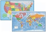
- Large 24x36 poster World and USA Maps - LAMINATED for Dry-Erase
- 2 Map Set - each wall map printed on 100lb paper
- 3D visual terrain relief of the World & United States
- Perfect World and USA map for business, home or educational use
- Completely up-to-date USA and World Wall Map Laminated Poster
The Vinland Map
The Vinland Map was once discussed as a possible early depiction of the New World, but Yale Library reported in 2021 that titanium compound first produced in the 1920s pervades its ink lines and text. Raymond Clemens, curator of early books and manuscripts at Yale’s Beinecke Rare Book & Manuscript Library, said, “The Vinland Map is a fake.” Yale presents the finding as the conclusion of its conservators’ and conservation scientists’ analysis; it is not evidence about the accuracy of Waldseemüller’s map.
Quick Recap
Best Value

- FOLDED EDITION - portable 8x10 inch folded size
- WORLD MAP is printed on 24lb paper
- 3D SHADED RELIEF: 3D shaded visual terrain relief for land and oceans
- PERFECT world map for business, home or educational use
- UP-TO-DATE: completely current world wall map poster
What the accuracy claim does—and does not—mean
- Supported: The map embodies major new geographic ideas, including a distinct Western Hemisphere and a separately represented Pacific, and a Librarian of Congress praised its “many elements” of geographic and cartographic accuracy in 2007.
- Not established: A numerical accuracy score, a complete coast-by-coast error analysis, or a definitive ranking against other early world maps.
- Important distinction: A map can be historically groundbreaking and accurate in some respects without being uniformly correct by modern geographic standards.

Product prices and availability are accurate as of the date/time indicated and are subject to change. Any price and availability information displayed on Amazon at the time of purchase will apply.